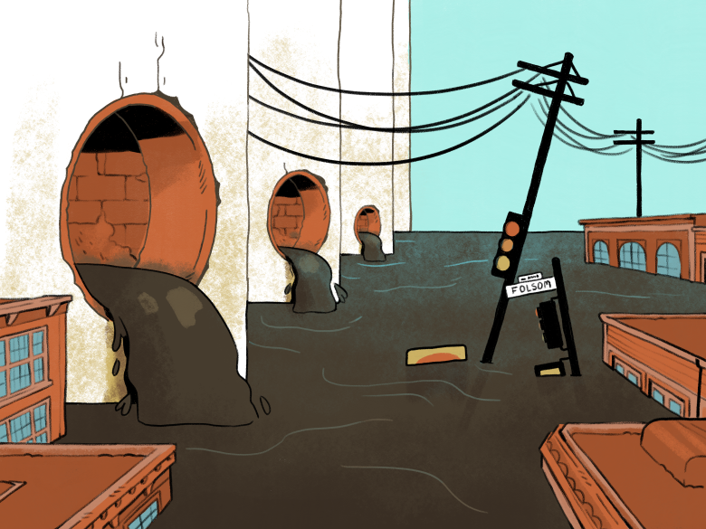

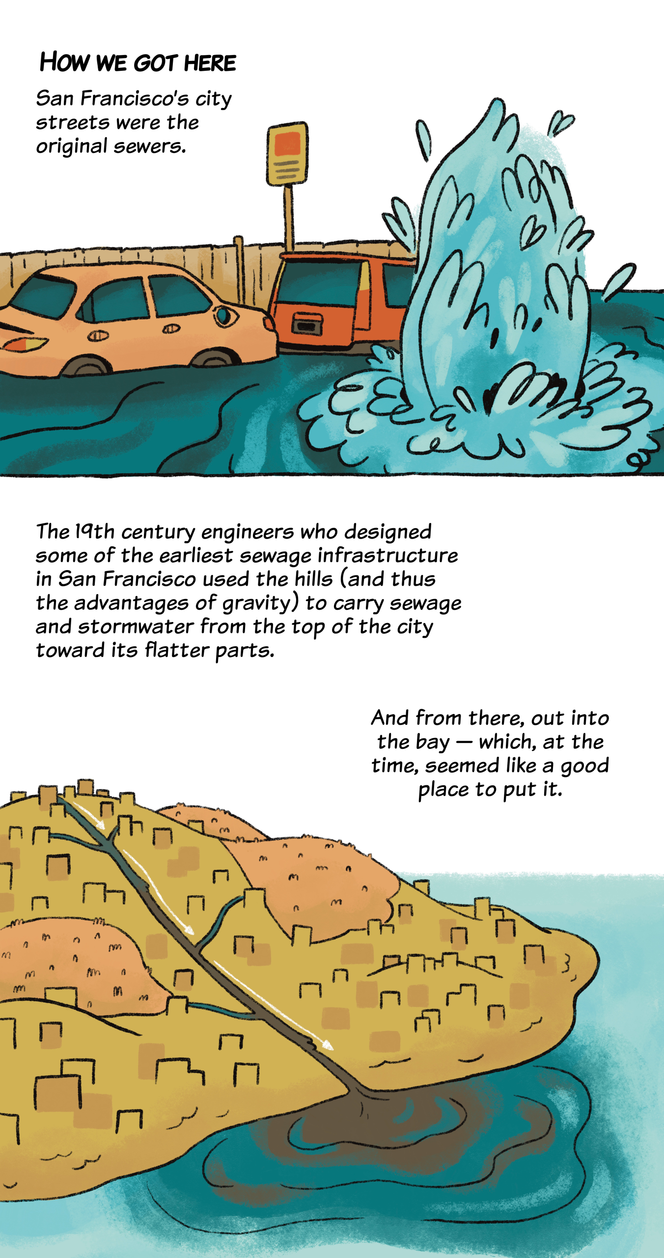
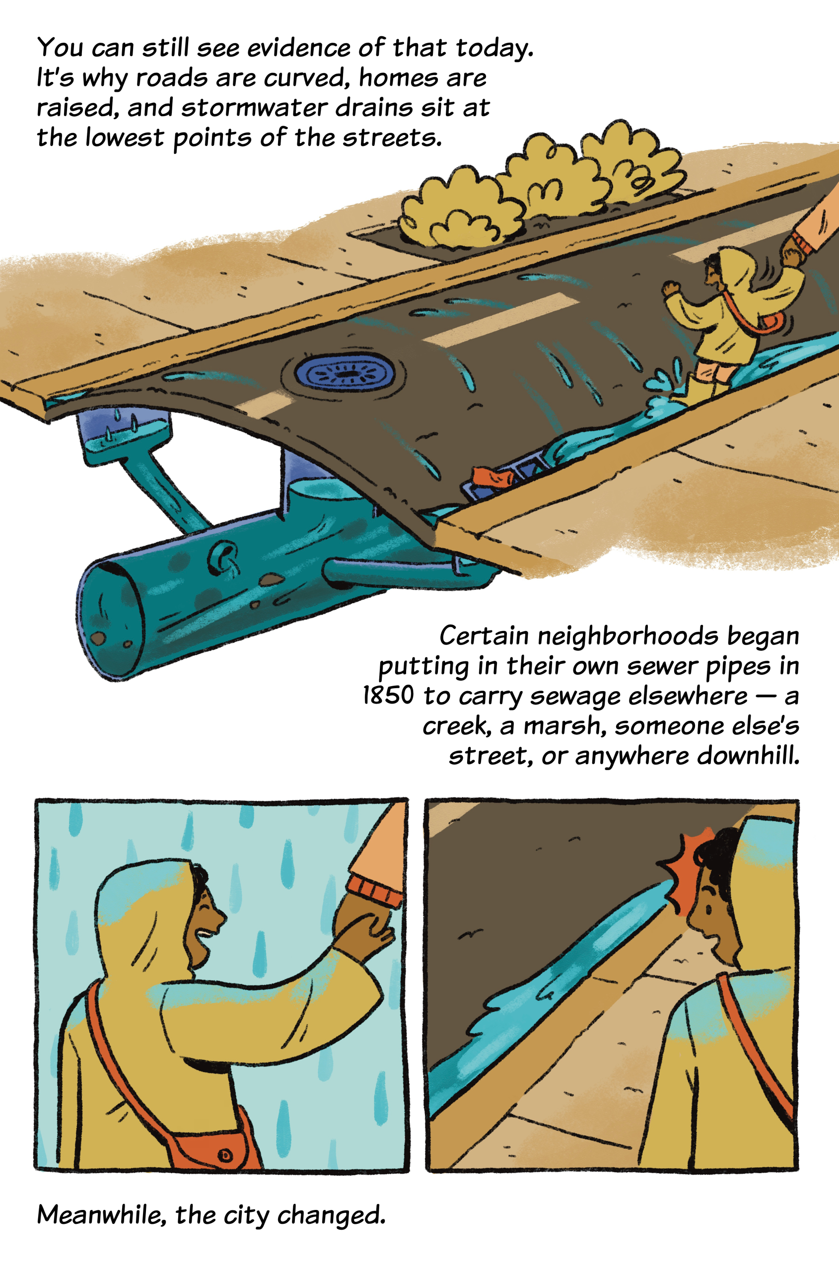
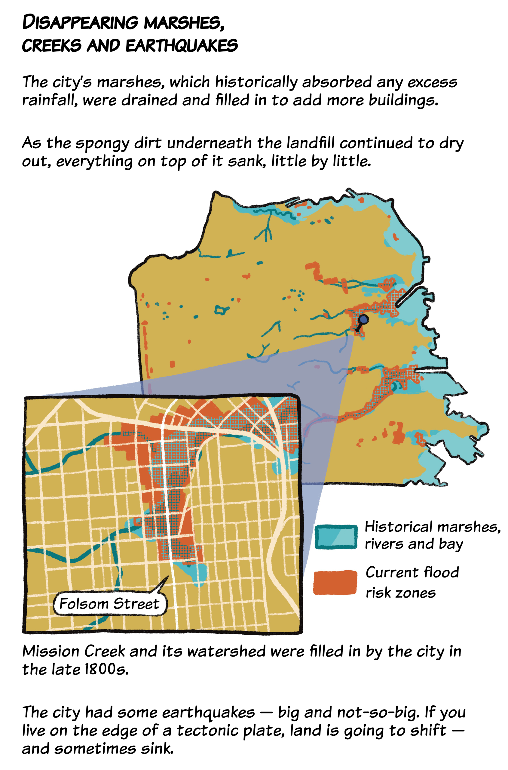
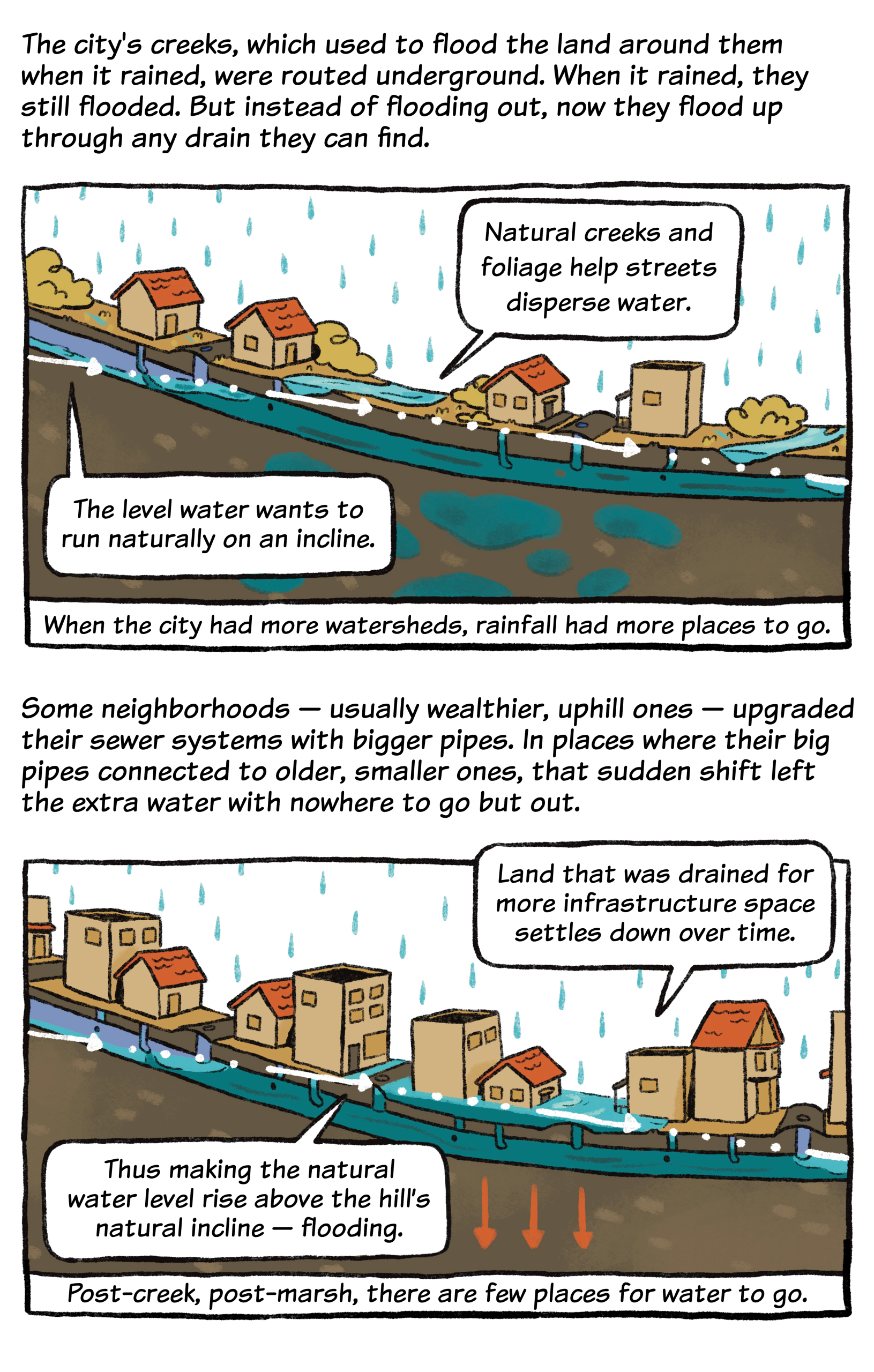
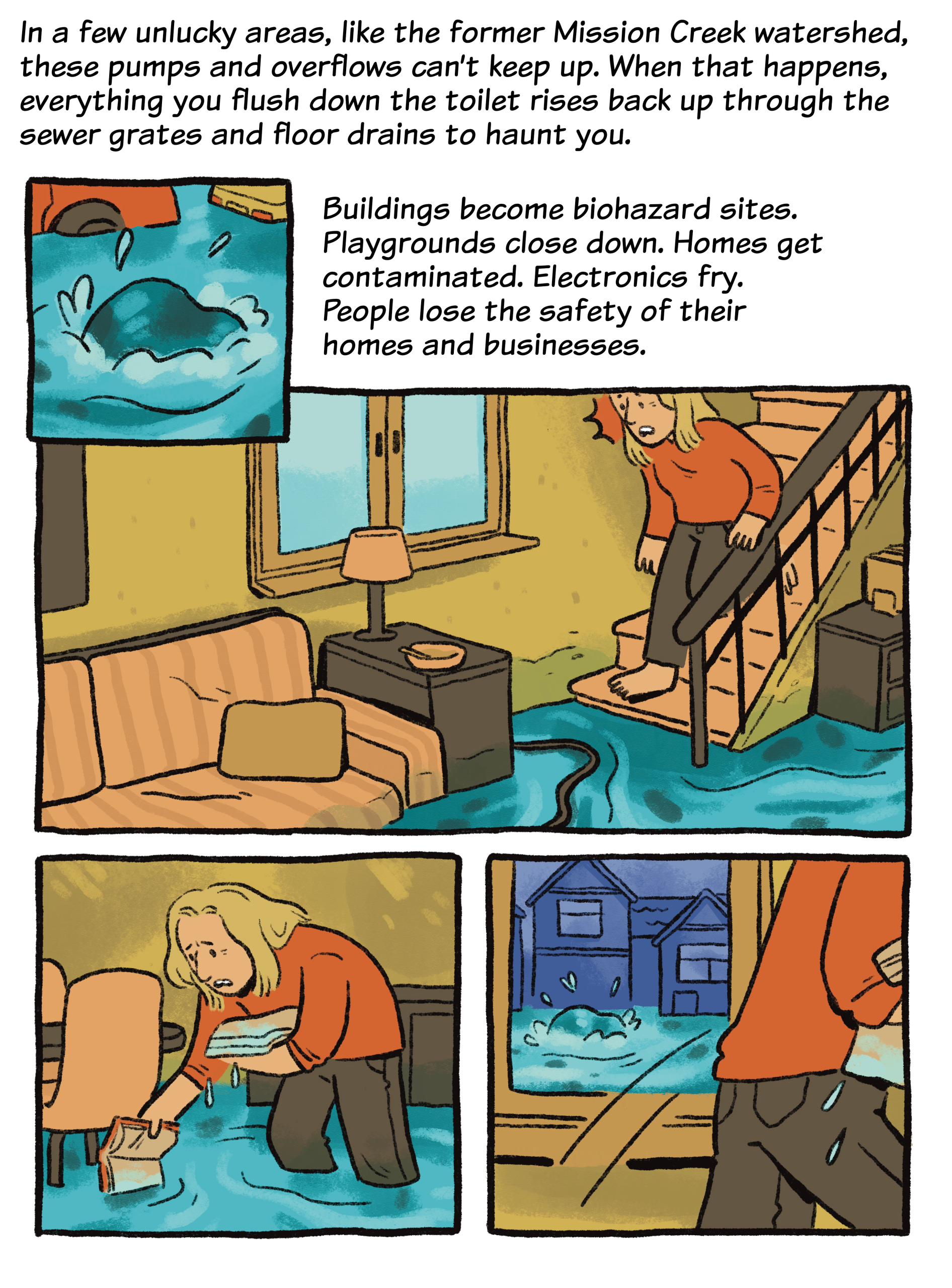
Every few years during the rainy season, certain neighborhoods of San Francisco flood.
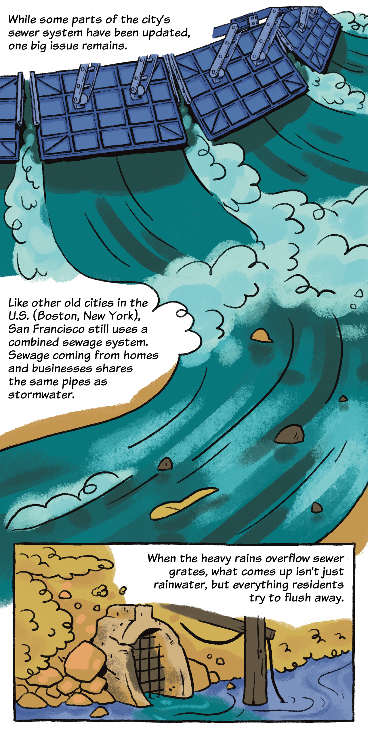
If it rains too hard or for too long, the sewer pipes fill, pushing water (and raw sewage) out of floor drains and sewer grates.
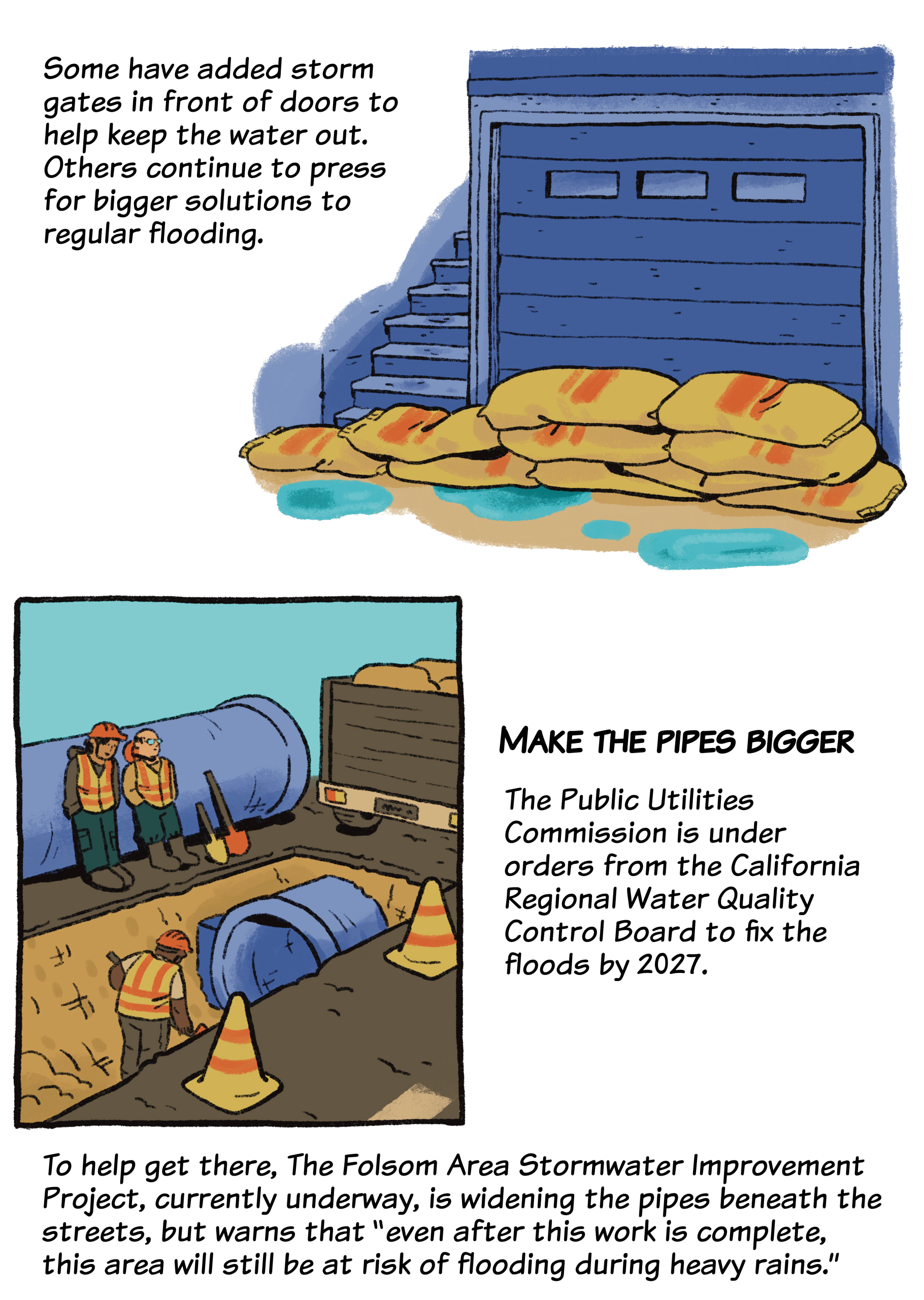
Residents and businesses near 17th and Folsom streets in the Mission spend every winter anxiously preparing for floods. City workers line the sidewalks with plastic barriers, and residents improvise their own designs. The damage is so costly, at that intersection and elsewhere, that sometimes businesses shutter.
Why do San Francisco’s sewers do this?
Super impressed by this piece, thank you Ronna! Great job creating a technically accurate simplification of a complicated and historic wastewater system that most folks don’t think about in their daily routine.
Lovely article and art!!! I feel like I know way more about our sewers now. Would love to see more informative comics like this one!
Thank you for this easy-to-understand explanation of a very complicated problem.
Amazing article and graphics! Thank you for explaining our historic/aging sewer system and its limitations. Its a great argument for permeable, green spaces.
Westside Water Resources is working to disconnect our roof rainwater from the sewer system to allow it to naturally filter back into the ground. This project, the Westside Basin Aquifer Recharge, will 1) restore the San Francisco peninsula’s Westside Basin Aquifer, 2) demonstrate the feasibility and environmental benefits of restoring the groundwater basins through distributed aquifer recharge, plus 3) relieve a stormwater/sewer system that the SFPUC has admitted cannot handle the volume of the projected rainfall.
Very good. As an aside it amazes me how many people choose to rent or (worse) buy homes in that area of 17th Street knowing, as they surely do or should do, that they have a fair to good chance of finding themselves under two feet of water every winter.
I guess those homes are cheaper, perhaps?
The further up a hill you are, the less risk you face. My excess rainfall passes through underground pipes I installed into the yard of the guy beneath me on my hill. No doubt he passes it on to the guy downhill from him. And so on all the way down to Folsom and 17th, where there is no more downhill.
“I guess those homes are cheaper, perhaps?” Bingo. I was thrilled to find a place I could afford that wasn’t within 1000 feet of a freeway = terrible air quality.
How eye-opening! Well, anyone in all your shoes would do the same,
My downstairs neighbor’s place had a floor very close to and maybe a little lower than street level. When it rained moderately hard, it was bad news coming out of her toilet.
Many SF basements need pumps (with battery backup) to stop them from flooding. But you still have the problem of where to pump that water to.
In flood conditions you can have geysers of water coming up out of the storm drains!
Doesn’t the Folsom Street project include a bored tunnel that runs from somewhere along Division to 7th and Berry which is out of the Laguna Dolores depression and lower in elevation that’s supposed to drain the basin no matter what?
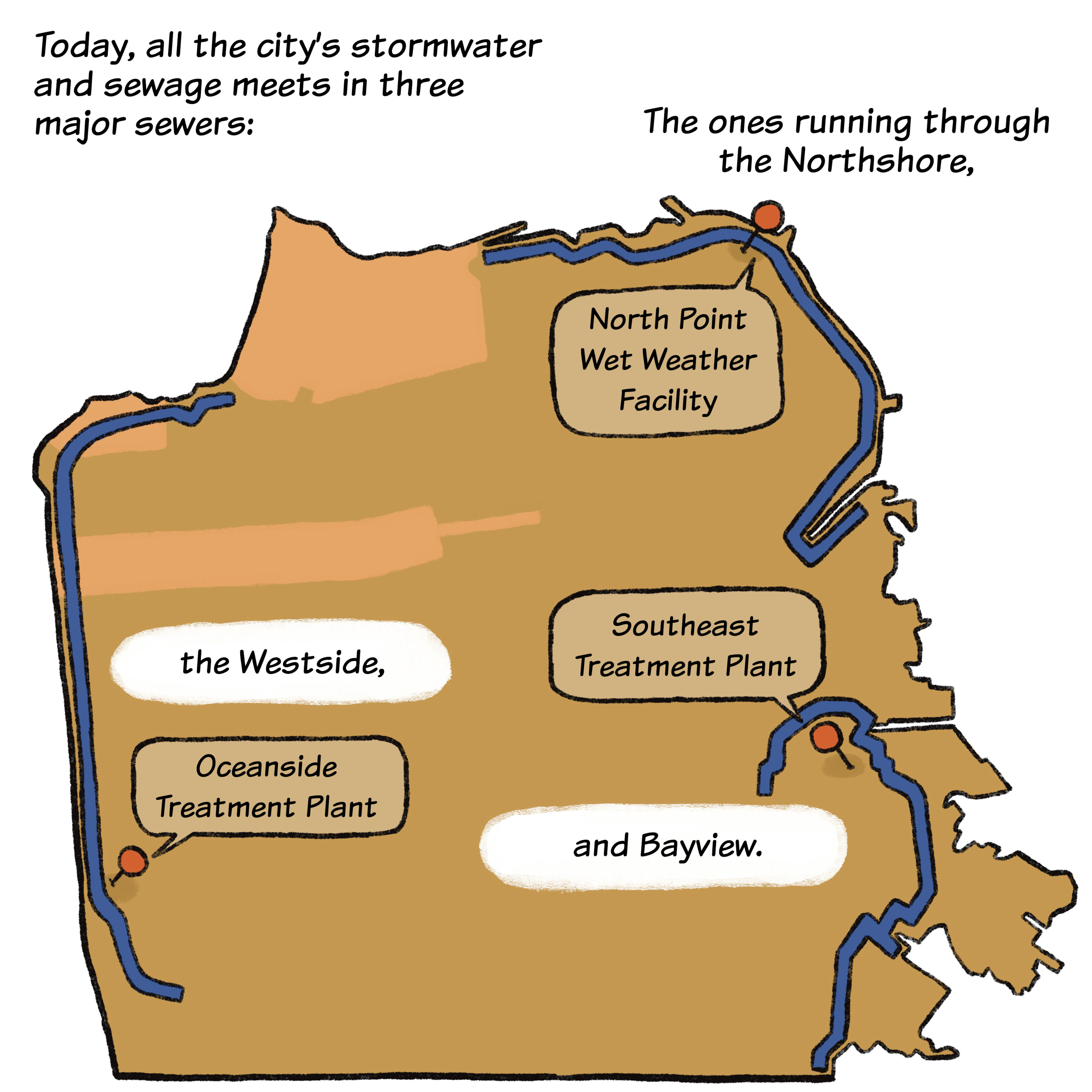
Great explanation of fairly complicated system. Interesting side note: the main sewer transport box for the Westside lives right under the asphalt of Sunset Dunes park. The east side of town has one under the Embarcadero. Both are turning into major liabilities due to sea level rise.
Let us not forget that Mayor London Breed sued the EPA to avert our City’s moral obligation to upgrade its sewer system! Thus San Francisco has played its part in further weakening the Clean Water Act and further degrading environmental laws. It is shameful that in one of the richest cities in the world the government has been heightening the influx of contaminants both locally and internationally—much like the dirtiest industries in the Third World. When will we Americans exercise more strength? When will we insist on justice? When will we willingly take responsibility for the impact of our actions? For the Law of Karma, the Law of Cause and Effect will ensure that ultimately we will be forced to take responsibility. So why not now?
Loved this format, very informative and fun to read!
Thanks for the detailed explanation!
Isn’t there some benefit with the combined sewers that during light rains, the dirt, oil, and other pollution from the road surface gets cleaned before going into the bay?
That first image with the pipes looks like the Vaillancourt fountain
This was so informative and cute and interesting! Thank you so much for making this!
PSA: To minimize flooding and raw sewage on our streets and into the bay/ocean when it’s raining moderately hard or more, use less water during storms:
– Shorten your shower
– Wait until after the storm to do laundry or turn on the dishwasher
– Flush your toilet less (yellow is mellow)
Good job explaining this complex issue in a fun way!
This is an excellent article. I’m glad I’ve donated here and will again today. I actually bought a house in the mission and the basement has flooded with pretty nasty water. It seems it is a back-flow from the sewer system (the previous property manger insisted it was just seeping in from outside during heavy rain, but black water shooting up out of the basement drains is kinda a giveaway!)
I’m pleased to see more information here! A while ago, I read a really neat article about the fire hydrant system and pumps and cisterns in the city. I would love to read something like that, but done in this same fashion with all the graphics.