
The recent howling winds that downed trees and knocked out power are just the opening stanza of two back-to-back winter storms heading for San Francisco.
The first storm “became more intense as it moved into the Great Basin” over Nevada and Utah, said John P. Monteverdi, professor emeritus of meteorology at San Francisco State University.
In the next three days, a second storm is bringing rain and colder weather to the Bay Area. If the snow line drops to 500 feet by Wednesday night, residents near Twin Peaks and Mount Davidson may see frost or minor snowfall, as the elevation in both areas are around 900 feet.
During the last 150 years, there have been only 11 documented snowfall events in San Francisco, according to the Golden Gate Weather Service. The most recent was in February of 1976.
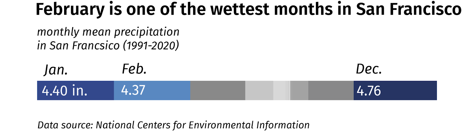
February is traditionally one of the wettest months for San Francisco. This year, however, it’s been dry, except for the rainfall at the beginning of the month. The deluge we saw in January is unlikely to repeat itself now, said Monteverdi, as that storm was from the southwest, with more subtropical water vapor.
Southern California will get some major rainfall in the coming days, with flooding. Los Angeles County just issued its first blizzard warning since 1983.
As strong winds ripped off tree limbs and caused widespread outages yesterday in San Francisco, it’s still wise to be cautious while walking under trees, and charge all your electronic devices and portable batteries.

