
Did your votes in the November election align with your next-door neighbors’?
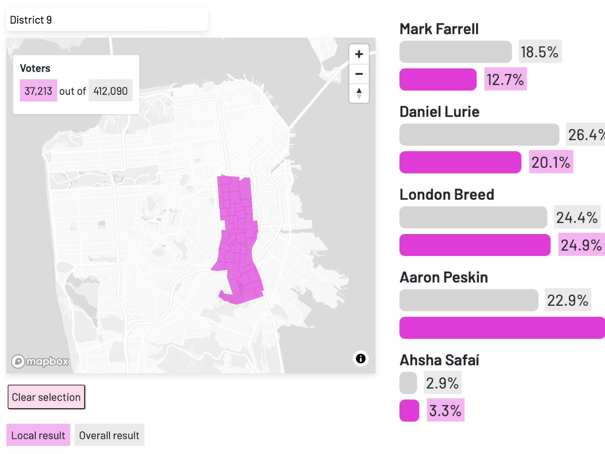
Use our interactive tool to select a precinct on the map and view the November election results in that area, compared to the citywide results. Curious about your whole neighborhood? You can also select a place or district from the dropdown menu.
For instance, you can see how voters in your area voted in the presidential election, the mayor’s race, supervisor race (if there was a supervisor election in that district), all 15 local ballot propositions — and more. Some races were distinctly divided by geography, such as Proposition K, to close the Great Highway, which received strong support on the city’s east side and strong opposition on the west side.
Click on the map to select a precinct, or choose from the dropdown below:
Methodology
This tool uses data from the San Francisco Department of Elections. The data was published on November 21, 2024.
Note: The results tables populate with all results available for all selected precincts. For instance, if two precincts in Districts 7 and 11 are selected, neither the District 7 supervisor race results nor the District 11 supervisor results will be displayed.
If you spot any errors, please let us know at kelly@missionlocal.com.
Excellent.
mr trumps do good in da poorer neighborhoods. maybe they know something us elites don’t?
There are mayoral candidates missing from this. Please fix the omission?