
This spring, Mission Local teamed up with the UC Berkeley Geography Department’s CAGE Lab to bring you Mission Possible, an atlas of 22 maps exploring our neighborhood.
In the past couple of days, news sites like the Atlantic and the Huffington Post San Francisco have discovered the map collection.
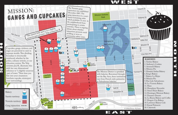
“The maps offer a detailed look at geographical elements of the neighborhood, from the locations of cupcakes and gang territory to low-income housing, to the contaminated underground sites of former gas station storage tanks,” wrote the Atlantic.
“One’s perception of a place is guided or framed by the thing they’re looking at. So if you’re looking at the coffee map, that’s what you think is going on in the Mission, because that’s the map you have in front of you,” project organizer Professor Darin Jensen said in the article.
Want to check out the atlas? You can check it out here.